Table of Contents
PEI Report Chapter 7 : Click Here
PEI Report Figures : Click Here
PEI Report Appendices : Click Here
Glossary : Click Here

Baseline
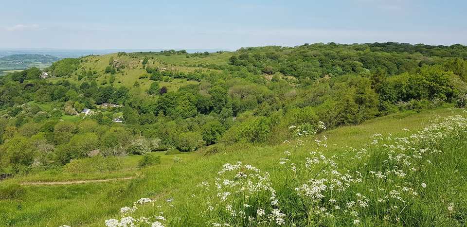
The proposed scheme would be situated in the Cotswold AONB, a landscape which is highly valued and designated for its scenic qualities and enjoyed by visitors and residents to landscape features including Crickley Hill Country Park, Barrow Wake, Leckhampton Hill and Coopers Hill. The landscape has a strong landscape character with a diverse and rich cultural heritage. Landscape features include the dramatic escarpment, which rises steeply up from the neighbouring low-lying vales before forming the open, undulating high wolds. Cotswold stone walling, beech hangers (woodland) and open long-distance views all form key characteristics of this landscape. The area’s rich cultural heritage is visually evident through Neolithic barrows, Iron age hill forts, historic medieval field patterns with ridge and furrow and later planned enclosures as well as historic parks and gardens.
Views to and from the escarpment and across the wolds are important to the AONB. Recreational viewpoints exist along the Cotswold Way National Trail and Gloucestershire Way long distance footpath, as well as other local public footpaths and cycle networks, Crickley Hill Country Park, Leckhampton Hill, Barrow Wake and The Peak. The proposed scheme has the potential to affect these viewpoints. Viewpoints which could also be affected include those from communities around Shab Hill, Stockwell and Brimpsfield, from employment and commercial viewpoints representative of Cowley Manor and The Golden Heart Inn, along with views from the road.
Construction
During construction, there would likely be significant effects on the landscape character within the study area and on the special qualities of the Cotswolds AONB, despite construction mitigation measures. These effects would mostly be temporary in nature, associated with temporary construction compounds and the presence of construction activities. The compounds include lighting, fencing and the storage of materials and laydown areas. Construction activities include felling of woodland, clearing of vegetation, large scale excavation across the site, earthworks to form landscape bunding and erection of retaining walls and overbridges. As the proposed scheme is gradually built throughout the construction phase, permanent effects would increasingly become part of the landscape and views.
Preliminary construction assessment
- Likely temporary adverse significant effects on the landscape character within the study area and on some of the special qualities of the Cotswolds AONB.
- Likely temporary adverse significant effects on landscape character types (LCT) and that are directly affected by the proposed development.
- Likely temporary adverse significant effects experienced by residents of Nettleton Bottom, Shab Hill, Stockwell, visitors to Crickley Hill Country Park, Barrow Wake, Great Witcombe Roman Villa, Leckhampton Hill and users of the Public Rights of Way (PRoW) network, including the Cotswold Way National Trail, Gloucestershire Way long distance footpath and local footpaths, bridleway and byways. Users of the main road network including the A417, A436 and B4070 would also experience likely temporary adverse significant visual effects.
Operation
The design of the proposed scheme has been developed to integrate the A417 into the existing surroundings, enhancing the local environment where possible.
Landscape and visual effects are likely to occur as a result of the long-term loss or changes to existing landscape features or characteristics, features or composition of a view, or the addition of new features within the landscape or view. Changes includes the presence of the widened road, the Cotswolds Way and Gloucestershire Way crossings, the overbridges at Cowley Lane and Stockwell Farm, earthworks and bunding, attenuation basins and the presence of replacement vegetation, particularly along the southern side of the A417 between Brockworth bypass and Air Balloon roundabout.
The visual character of the area is likely to change as a result of the presence of the widened road, the overbridges, and changes to vegetation along the southern side of the A417. Large areas of calcareous grassland and woodland will be created, replacing more than what would be removed. The proposed scheme also includes long sections of hedgerows and Cotswolds stone walling to create a rich network of robust landscape features.
Preliminary operation assessment
- Combination of likely permanent adverse effects (at year 1) and neutral effects (15 years after opening) for residents of Shab Hill and Stockwell.
- Combination of likely permanent adverse effects (at year 1) and neutral effects (15 years after opening) for visitors to Barrow Wake and Great Witcombe Roman Villa.
- Likely permanent adverse effects experienced by visitors to Crickley Hill Country Park at year 1 and year 15.
- Combination of likely permanent adverse and neutral effects experienced by users of the PRoW network, including the Cotswold Way National Trail (adverse at year 1 and year 15), Gloucestershire Way long distance footpath (adverse at year 1 only) and local footpaths, bridleway and byways (adverse at year 1 only).